Mallina Project – Pilbara, WA (Lithium-Pegmatite)
Overview
The Mallina Project is situated approximately 80 km southwest of Port Hedland within the northern Pilbara region — a district that hosts world-class lithium deposits such as Wodgina and Pilgangoora. The project encompasses a series of under-explored greenstone and granitic terrains with known pegmatite intrusions, providing exposure to a proven lithium corridor.
Early reconnaissance has identified fertile granitic intrusions and pegmatite outcrops consistent with lithium–caesium–tantalum (LCT)-style mineralisation.
Exploration Highlights
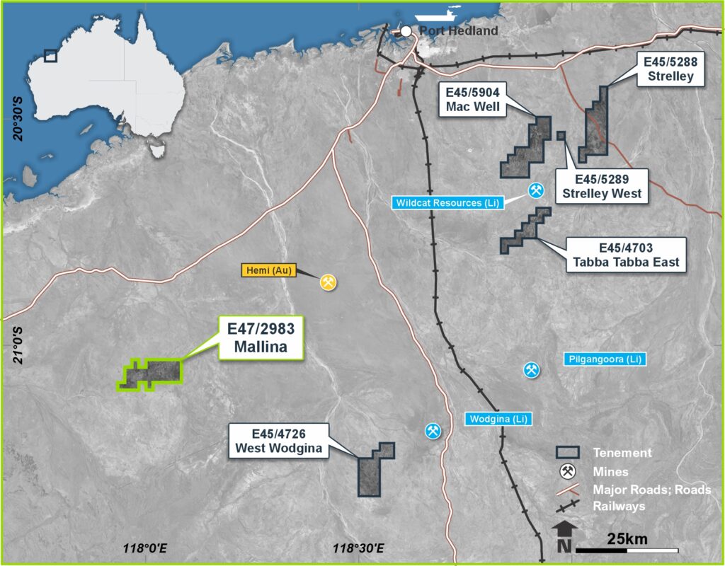
Figure 1: Location map of the Mallina Lithium Project tenement in relation to additional earn-in tenements and operating mines within the northern Pilbara, Western Australia

Figure 2: Mallina Basin

Figure 3: Spodumene-bearing dyke seen at the Mallina Lithium Project
Click here for further information and detailed exploration results in issued ASX releases.
Mt Edon Project – Mid West, WA (Rubidium-Lithium)
Overview
The Mt Edon Project is located approximately 5 km southwest of Paynes Find in Western Australia’s Mid West region. The project hosts a series of highly fractionated rare-metal pegmatites enriched in rubidium and lithium, representing one of the few documented rubidium-dominant systems in Australia.
Hydrometallurgical test work undertaken by Edith Cowan University (ECU) achieved rubidium extraction efficiencies approaching 90% under optimised roast–leach conditions, confirming a strong technical basis for further optimisation and scale-up. Morella controls 51% of the pegmatite mineral rights in joint venture with Elevra Lithium Limited (ASX: ELV, formerly Sayona Mining Limited).
Exploration Highlights
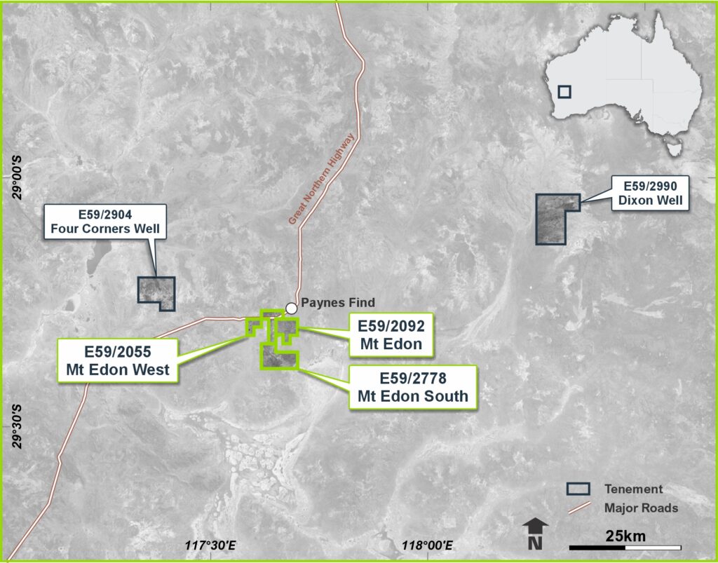
Figure 1: Location map of the Mt Edon Project
Tabba Tabba Project – Pilbara, WA (Lithium-Tantalum)
Overview
The Tabba Tabba Project lies within the Pilbara lithium province, adjacent to Wildcat Resources’ lithium development and within the broader Pilgangoora–Tabba Tabba greenstone belt. The project covers prospective structural corridors that host lithium-caesium-tantalum (LCT) pegmatites associated with fertile granitic intrusions.
Recent work by Morella has focused on surface mapping, geochemical sampling, and assessment of historical datasets to refine target areas for follow-up drilling.
Exploration Highlights
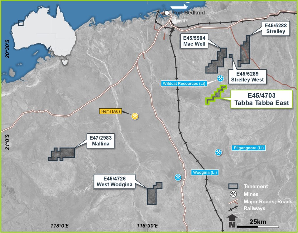
Figure 1: Location map of the Tabba Tabba East Project
Dixon Well Project – Mid West, WA (Titanium-Vanadium)
Overview
The Dixon Well Project is located in the Mid West region of Western Australia, approximately 140 km southeast of Mt Magnet.
It covers a sequence of mafic–ultramafic intrusions and associated titaniferous magnetite horizons prospective for titanium and vanadium mineralisation.
Initial reconnaissance and historical datasets indicate the presence of Fe–Ti–V-rich units within the local stratigraphy.
Exploration Highlights
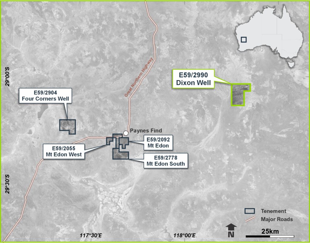
Image 1: Location map of the Dixon Well Project
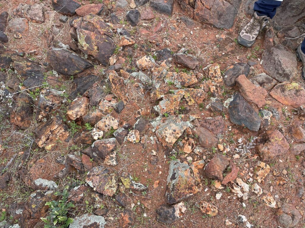
Image 2: Ilmenite bearing quartz vein
Fish Lake Valley Project – Nevada, USA (Lithium Brine)
Overview
The Fish Lake Valley (FLV) Project is located in western Nevada, within the Esmeralda lithium brine province that also hosts the nearby Silver Peak operation — North America’s only producing lithium brine mine.
The project covers an extensive area of playa sediments prospective for lithium-bearing brines and claystone mineralisation.
Fish Lake Valley provides Morella with exposure to the U.S. critical-minerals supply chain and a jurisdiction actively prioritising domestic lithium production to support battery and energy-storage industries.
Exploration Highlights
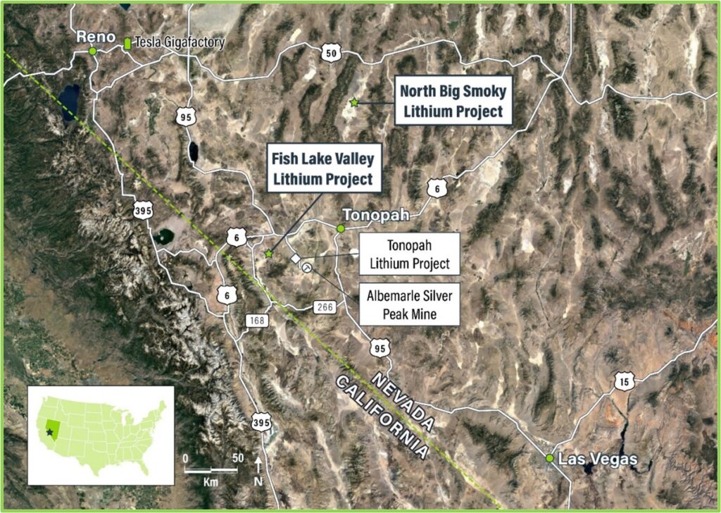
Figure 1: Location map of the Fish Lake Valley Lithium Project

Figure 2: Fish Lake Valley Lithium Project playa
Click here for further information and detailed exploration results in issued ASX releases.
North Big Smoky Project – Nevada, USA (Lithium Brine)
Overview
The North Big Smoky (NBS) Project is located in central Nevada, approximately 30 km north of Tonopah, and forms part of Morella’s strategic portfolio of lithium brine assets.
The project lies within a structural basin interpreted to host lithium-enriched brines and clay sequences analogous to those at Fish Lake Valley and other regional systems.
The NBS Project adds scale and geographic diversity to Morella’s U.S. operations and strengthens the company’s exposure to emerging domestic lithium development opportunities.
Exploration Highlights
Figure 1: Location map of the North Big Smoky Lithium Project
Projects Overview – Philosophy
Advancing a portfolio of critical-mineral assets in Tier 1 jurisdictions, Morella Corporation Limited (ASX: 1MC) is an exploration and resource development company focused on advancing a portfolio of lithium, rubidium and other critical-mineral projects across Australia and North America.
The company’s strategy is to identify and progress technically robust, strategically located assets that support long-term demand for clean-energy and advanced-technology materials.
Morella’s project portfolio is deliberately diversified across two complementary regions:
Australia – Critical-Mineral Projects
Australia remains the cornerstone of Morella’s growth strategy, hosting projects that span lithium, rubidium and tantalum mineralisation within proven mining districts.
Key Australian projects include:
Each project is positioned within accessible mining regions with supportive infrastructure and strong regulatory frameworks, ensuring a clear pathway from exploration through to potential development.
North America – Lithium Brine Projects
In the United States, Morella maintains strategic exposure to Nevada’s lithium-rich basins, supporting U.S. domestic supply initiatives.
Key North American assets include:
These projects collectively position Morella within one of the world’s most active lithium exploration jurisdictions, contributing to the company’s broader commitment to supply-chain security for critical minerals.
Focus
Morella continues to advance its exploration and test-work programs through disciplined, science-based methodologies in collaboration with research partners such as Edith Cowan University.
This approach ensures that each project is progressed methodically, with a focus on technical quality, environmental responsibility and long-term value creation.
